


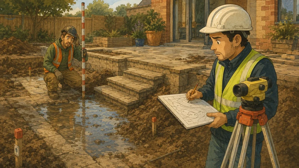
You find out months later, when water sits where it should drain, when a flight of steps arrives at the terrace three inches short, or when a contractor stands in the garden with a laser and says the words nobody wants to hear, which are some version of this does not match what I was given.
By then the design changes is done, the materials are ordered, and the cheapest survey quote you accepted has become the most expensive line in the project.
A level Error Is Not a Small Error, Because Everything Downstream Inherits It
Here is the thing that makes vertical mistakes different from most survey problems. Horizontal errors tend to be visible, since a wall in the wrong place looks like a wall in the wrong place. Vertical errors hide inside a design that is internally consistent and simply sits on a false floor.
Your designer takes the levels and calculates falls, step risers, retaining heights, cut and fill volumes, drainage runs, the height of a terrace relative to a threshold. Every one of those numbers is derived from the survey. If the survey is out by a hundred millimeters in one corner, nothing in the drawing set contradicts anything else. It is all beautifully coherent and all wrong by the same amount, and it stays wrong right up until somebody builds it and reality declines to cooperate.
Datum, Defined
The reference surface all your heights are measured from. Every spot level on the drawing is a distance above or below it.
Get the datum wrong, or fail to state which one was used, and the survey is internally consistent while being wrong relative to the world. Surveys should be tied to a recognised vertical datum, Newlyn in the UK, NAVD 88 in the US, and the reference and basis of that datum should be stated clearly on the drawing.
If your survey does not name its datum anywhere, that is not a stylistic omission. It means nobody can check it later, including the next landscape surveyor.
The Five Things I Would Now Check Before Hiring Anyone

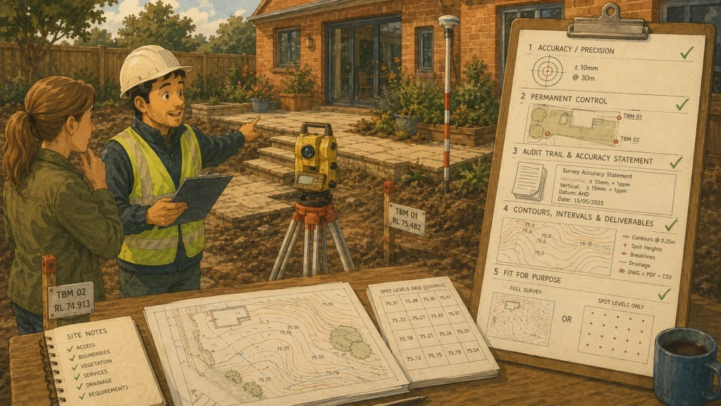
Not one of these occurred to me the first time. All of them are standard practice, which is the frustrating part.
- Which accuracy band are you working to? RICS guidance sets defined bands. Band F, a common specification for topographic work, gives height accuracy of ±50mm on hard detail and ±100mm on soft detail. A surveyor who answers this immediately has done it before. A surveyor who asks what you mean has told you something.
- How many permanent control markers will you leave on site? The standard specification is at least two, and better practice for larger sites is three independent benchmarks verified against the project datum. These matter enormously, because they are how anyone checks or extends the survey afterwards without starting again.
- Will I get an accuracy statement and check point residuals? Proper deliverables include the control network with station coordinates, a GNSS observation log, independent check point residuals and a final accuracy statement. That is the audit trail. Without it you have a pretty drawing and no evidence.
- What contour interval, and what is the deliverable list? Typical intervals are 0.25m or 0.50m, with break lines and spot heights, layered CAD ready for your designer to overlay.
- Do I actually need a full topographic survey? Sometimes a grid of spot levels is enough for a preliminary study, and a good surveyor will say so rather than selling you the full package. Somebody who never suggests the cheaper option is worth watching.
Check The Survey Yourself Before The Design Starts
This is the part I skipped, and it takes about twenty minutes.
Industry guidance on reviewing survey reports puts it bluntly never assume a certified stamp guarantees accuracy, and always spot-check known site features against your own field observations.
You do not need equipment for a basic sanity check. Take a tape and a long spirit level, or borrow a laser, and test three things. Pick two points on the drawing whose height difference you can measure yourself, a step, a threshold, a wall course, and see whether the survey agrees. Check that the datum is named. Check that the control markers exist physically where the drawing says they are.
Any one of those failing is a conversation to have before the designer starts calculating, not after the groundworks quote arrives.
Would that have caught our problem? Honestly, yes. A five minute check between a doorstep and a manhole cover would have shown the discrepancy, and I did not do it because the Survey and Spatial New Zealand or the Surveying and Spatial Sciences Institute drawing looked professional and I assumed professional meant correct.
What To Do When The Levels Turn Out to Be Wrong
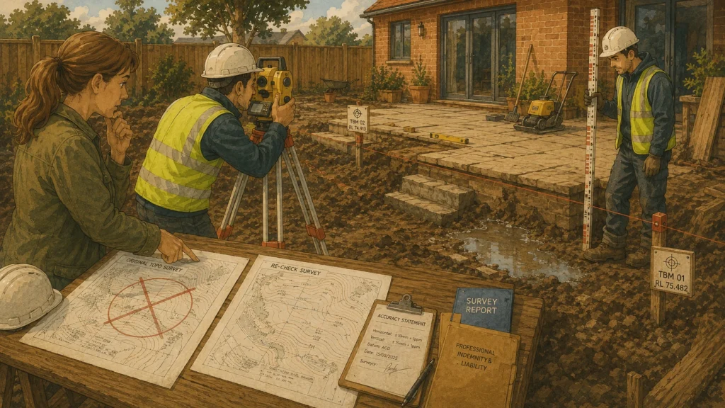
Stop the design work immediately. Every hour spent designing on bad data is money you will spend twice.
Get the survey re-checked, ideally by a different firm, and ask specifically for a comparison against the original control. If the original surveyor left no permanent markers, that comparison becomes much harder and much more expensive, which is why the marker question matters so much at hiring stage.
Then have the conversation about liability with the original firm. Surveyors carry professional indemnity insurance and a demonstrable error against a stated accuracy band is exactly what it exists for. This is the reason the accuracy statement matters. Without a specified tolerance, arguing that a survey was wrong becomes a matter of opinion rather than a matter of measurement.
And check whether they are actually regulated. A firm operating under RICS regulation, or the equivalent professional body where you are, has a complaints process attached to it. A one-person operation with a total station and a website does not, and that difference only becomes relevant on the day something goes wrong.
The Cheapest Quote is Almost Never The Cheapest Survey
Topographic survey pricing for a domestic garden project is a small fraction of the build cost. Ours was the smallest invoice in the whole job and caused the largest overrun, which is a ratio worth remembering when three quotes arrive and one is noticeably lower.
What you are paying for is not the day on site. Anybody with the kit can walk a garden with a total station. You are paying for the control network, the datum discipline, the check points, the accuracy statement and the professional indemnity behind all of it.
Ask for those specifically. If the quote does not mention them, the price is lower because those things are not in it.